The Moon and recent seismic activity
WEDNESDAY NOVEMBER 28, 2012
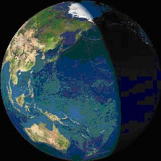
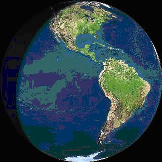
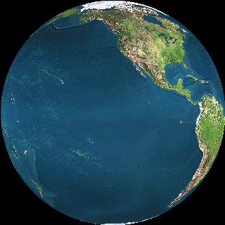
(pic: View from the Moon on 13 December)
One day a reliable method of predicting seismic events by mainsream scientists will be a possibility. Right now geologists say this can never be done because such events will always be random in nature. This article is to let you, the reader decide. I am not a geologist and this article is merely my opinion. It is what I believe, but only from my own private research.
Others are perfectly free to dispute these findings, and discussion is always good science. I will set out some facts and the actual predictions will be up to the reader. When the time comes around, in about two weeks from this writing, we will be able to see how well this method performed. It will then be encumbent on either the geologists or those like myself with alternative ideas to re-examine their beliefs.
Like all science this is a work in progress. But nothing ventured nothing gained. This is not an attempt to scare anyone, rather the complete opposite. Having a method of earthquake prediction would finally mean that no one living in an active earthquake country needs to be constantly afraid any more, because something expected or anticipated around a certain date cannot take one by surprise. Neither can it prolong anxiety if clusters of earthquakes can be shown to arrive and depart to a pattern.
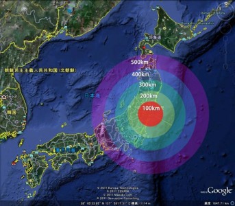
Let us begin this journey looking back to Friday, 11 March 2011, the day of Japan’s giant 9.0mag earthquake/tsunami, beginning as it did at 05:46 Universal Time. It was the biggest calamity in Japan's history, and as times and events go, one for the history books. At that exact moment, the Moon was at longitude 162° East. Japan lies at 135°E and the Moon moves 15° longitude, about 1700 km over the surface of Earth every hour.
It means the Moon was almost overhead when the earthquake struck. Two hours later the Moon reached the other side of Japan. If anyone on the ground were looking up, the Moon would have been seen passing overhead and across the southern portion of the Japan sky as the whole disaster unfolded. It was also the narrow date range in which the Moon was the closest to earth for the past 19 years.
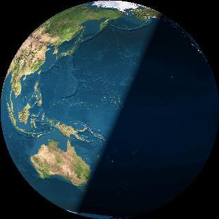
This is the view from the Moon at the moment of the Japan earthquake's initial strike.
Japan was not alone in receiving a substantial event in the February-March 2011 period. Christchurch suffered badly on 22 February and there were many other unusually large earthquakes around the world. We do not have time here to discuss them all. What does concern us here is a glaring fact that appears to have not been realised yet by geologists and seismologists, despite our advanced technology of satellites and computers.
This is that during an earthquake, the Moon is invariably directly overhead of the location. It may be a giant coincidence or it may point to something scientists have thus far missed, being that the Moon seems to be a silent player in either producing, triggering or directing the event. For instance, there seems to be only four possible Moon positions in the sky at the time of an earthquake or eruption. These are:
1) the Moon is directly above (or below) the location of the disturbance (conjunct)
2) the Moon approaches from 2-3 hours away, to exert pressure beneath the crust? (semisquare);
3) the Moon is 2-3 hours distant, allowing pressure to escape? (semisquare)
4) the Moon lags 5-6 hours behind (midpoint), which happens to be the opposite tide time, thus waiting for next cycle of land-rise?
If we take 10 past earthquakes, mostly in the past month as examples, we can see this pattern in action. (times quoted are UT):
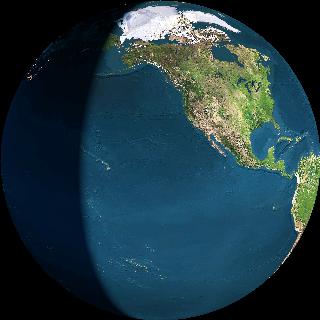
1. On 16 Oct, at 23.42, a 5.5mag struck Tokoroa, NZ, and the Moon was directly overhead 1 hour later. (New moon+perigee, kingtide). This is the view from the Moon at the moment of the earthquake:
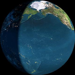
2. On 20 Oct, at 23.00, a 6.6mag earthquake struck Vanuatu. The Moon was overhead at Vanuatu 6 hours later.(kingtide, southern declination)
3. On 28 Oct, at 03:04, a 7.7mag earthquake struck Queen Charlotte Sound, Canada. At 06:00 the Moon was overhead but in the southern sky. (kingtide, full moon). It would have appeared to have passed overhead during the event:
View from the Moon:
4. On 2 Nov, at 18.17, a 6mag earthquake struck Mindanao, Philippines. The Moon was directly overhead. (kingtide, northern declination).
View from the Moon:
5. On 7 Nov, at 16.35, a 7.3mag struck Guatemala coast. The Moon was overhead at 13.35 (last quarter + neap tide), 3 hours beforehand, and would have been seen to pass across the sky after the initial strike and during the aftershocks.
6. On 10 Nov, at 14.57 a 6mag struck Central Peru. At 13.57 the Moon was directly overhead. (lunar equinox).
View from the Moon:
7. On 11 Nov, a 7+mag struck at Myanmar, as the Moon was directly overhead. (lunar equinox, 3 days before new moon+perigee and kingtide)
8. On 21 Nov, at 1.25, Mt Tongariro in the North Island of NZ erupted, and 5 hours later the Moon was overhead.(1stQ and neap)
9. On 6 Aug, at 11.50, the last time Tongariro erupted this year, the Moon again lagged 5 hrs behind.
10. On 10 June, at 0-2am, Mt Tarawera erupted, in what has been the largest eruption in settled times. Wikipedia says
"Shortly after midnight on the morning of 10 June 1886, a series of more than 30 increasingly strong earthquakes were felt in the Rotorua area and an unusual sheet lightning display was observed from the direction of Tarawera. At around 2:00 am[1] a larger earthquake was felt and followed by the sound of an explosion. By 2:30 am Mount Tarawera's three peaks had erupted, blasting three distinct columns of smoke and ash thousands of metres into the sky. At around 3.30 am, the largest phase of the eruption commenced; vents at Rotomahana produced a pyroclastic surge that destroyed several villages within a 6 kilometre radius, and the Pink and White Terraces appeared to be obliterated."
We can now ask, where was the Moon? The Moon reached perigee position on 6 June, where it stayed for a few days. 5 hours previous to the initial eruption, at 7pm the Moon passed over NZ.
View from the Moon at 7pm on 9 June 1886
The 4 September 2010 event
The initial sequence of destructive earthquakes began in Christchurch on 4 September, with the massive 7.1mag shake. On 4 Sept at 4.30am, at the exact time of the event, this was the
View from the Moon :
and 3 hours it moved to here!
View from Moon
It was 4 days to go until the second closest 'perigee' for the year. Scroll down to find out what perigee means. On 8 September 2010, the actual day of this perigee, a 5.0mag occurred.
View from the Moon time of 5.0mag:
and 3 hours later it was here:

which again is dead square over NZ.
During 2011 the next largest earthquake was always on or near perigee day.
After the perigee of 8 September 2010, the earthquakes died down in magnitude for Christchurch. In fact, there was not another 5+ shake until 26 days later, on 4 October, which was exactly a month after 4 September.
At the time of the 4 October shake the moon was here.
View from the Moon
this time it would be 12 hours before the Moon was directly over NZ.
View from the Moon
The pattern seems to hold true. It appears that at the moment of every large eathquake, the Moon is either above (mid-heaven), below (12 hours away), on the horizon (6 hours away) or halfway between horizon and mid-heaven. There does not seem to be any variation from this. We can theorise then that the Moon may be some sort of trigger. It is easy enough to plot the future path of the Moon at any time. It is also easy enough to find out when the next perigee returns.
So is there an earthquake every time the Moon comes over? The answer is yes, that is the daily land tide itself. It is little known that every landmass has a daily Land or Earth Tide. Every day the landmass of NZ rises vertically by 20cms and recedes again. Australia rises by 50cms and land at the equator by 55cms. The largest landmass in the world is Eurasia. It is the reason that Japan, sitting on the boundary of Eurasia and the world's deepest ocean, gets the most earthquakes; 80% of all in the world.
We cannot see this Land Tide because we have nothing to compare it against. We only see the sea tide as compared with the land. When the seatide is low the Land tide is high, because the sea tide is only what we see when the land pulls out and away from the water. The next question is, when does the land tide become big enough to be called an earthquake and a rumbling destructive thing? Answer: when the Moon is in 'perigee', new or full moons, when there is an increase in sunspots within 24 hrs, and when there is a significant alignment of inner planets with Earth and Sun. All of the aforementioned 1-10 of seismic events had several of these combinations.
Perigee
The Moon comes closer to earth every 27.5 days, called 'perigee' by astronomers. The distance of Earth-Moon can vary by over 50,000kms. There are usually 13 perigees per year.
The 13 December is our next perigee
.
On 13 December the Moon comes the second-closest to earth that it will ever come for the whole of 2012. Perigee brings the biggest seatides of any month, called kingtide, It is really the kingtide of the land beneath the sea, and land rises and falls more on kingtide day than at any other. There are many hundreds of kms of land, but only 1-2kms of ocean depth.
Perigees vary through the months. The closest perigee is more powerful and brings more destructive weather than the furthest away. When the Moon was second-closest to earth in 2010 – that was the time of September's 7.1mag earthquake in Christchurch. On that day at 4.30am the Moon passed over Hawaii and crossed NZ in three hours time.
The second-closest perigee in 2011 was on 27 October, and a 5.2mag shook the North Island at 7.30pm. That close perigee Moon transited NZ, 6 hours beforehand. At the exact time of the perigee itself, the Moon transited Chile, unleashing a volcano after 20 years of silence, creating a cloud of smoke 1 km high. Two days before, 3 hours after the Moon transited eastern Turkey, a 7.2mag struck the city of Van, killing 604 people. Five days before, as the Moon passed over the Kermadecs at 7am, a 7.3mag shake was sprung, sparking a tsunami alert in NZ.
The pattern repeats each time. The transiting Moon exerts pressure deep within Earth, pressure rises and pushes aside plates.
The earthquakes create tectonic plate movements, not vice versa.
I will be showing you that the possible risk time is, from just after midnight on the 13th to just after lunchtime on 14th. The key area could be the Central Plateau but other areas affected may also be East Cape, Wellington, Northland and Christchurch.
The unusual feature of 13 December is that the Moon is exactly in perigee that day, around noon, and will be exactly overhead.
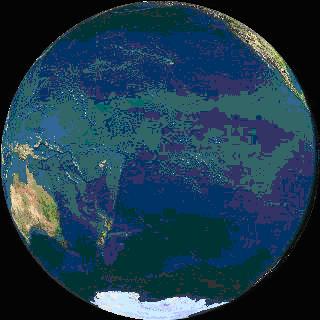
View from the Moon at time of perigee, coming up at 12.15am on 13 December 2012
The Moon will be transiting NZ in the same way Japan was transited, the difference being that during February-March 2011 the Moon was the closest to earth for 19 years, and it is not that close any more.
So on 13 December we will have close perigee, new moon, and Moon at southern declination (meaning the Moon is over the southern sky) and looks likely to be a day of increased sunspot numbers. Also, we are expecting a cyclonic event over southern Fiji at that time. Not a cyclone but perhaps a tropical low. Perigees bring turbulence in air, sea and land and affect a wide area beneath.
Can we predict anything? That is entirely up to the reader. Because anxiety comes from the unexpected surprise, when you can anticipate something you remove surprise. It is why we have science. And yet predicted events may not happen, because nothing in science is certain. With potential comes risk and indeed from the above information, the potential does look high on 13 December for a significant event in NZ.
I would not suggest packing up and leaving town, because such an event can happen anywhere in a seismically active country. But it is one day when we might be wise to observe caution and suspend complacency. If the air goes still and birds stop singing, and animals scramble to get out of enclosures and head for open ground, and if the barometer is rapidly on the move then the land may be too. It may be prudent to stay away from old stone buildings, especially ones already cracked. We might remain within contact of loved ones, and of Civil Defence, and concentrate on being more careful than on normal days, and thus staying safe.
It is not possible to get certain or specific in this work, because even when maximum stress is exerted on the interior of the planet, the effects of that stress may not be immediate. It is fairer to allow a reasonable time frame, and observe vigilance between the start and finish of the interval under consideration.
In this, the method is no worse than the forecasts that the Metservice deliver each day, in which percentage “confidence” levels are issued about rain events in a locality. What is good for the weather goose should therefore also be good for the earthquake gander. With this in mind the method offers some promise that is better than nothing. Because we receive no funding it is impossible for my own small team to watch all locations every minute of the 24-hr day. This article is an overall glossing of the factors to look for. It is up to geologists to take over and keep the public informed of which drums near which population centres may be showing initial signs of unusual disturbance around 13-14 December.
But if and when this method is finally accepted by geologists, and they can use it for the good of the people, and they can rid themselves of their ‘astrology’ phobia, perhaps funding can be directed towards constructing a computer program that is dedicated to finding around-the-clock aspects for individual towns. For instance, the Wellington City Council, or Welllington Civil Defence would be well positioned to take notice of what may be coming down the track. We have looked at the information for this article from 3 weeks back. But it could just as easily have been 30 or 300 years.
Some have a problem with astrology because planets are mentioned as having a gravitational stress on the earth. But this does not have to be labelled astrology, not that it would matter anyway, but many think that astrology only refers to the light entertainment fortune-telling that can be found in the back pages of women’s magazines. Most astrologers would distance themselves from that form of it, and lean more towards astronomy. If one thinks that reciting planets makes one an astrologer, then anyone who mentions the days of the week must also be an astrologer, as they are named after the planets:
Monday (Moon’s day),
Tuesday(Tiw’s Day, god of Mars),
Wednesday (Woden’s day – god of Mercury),
Thursday (Thor’s day – god of Jupiter),
Friday (Freya’s day – god of Venus),
Saturday (Saturn’s day) and
Sunday (Sun’s day)
--------------------------------------------------------------------------------------------------------------------
--------------------------------------------------------------------------------------------------------------------
Planetary influences
We now come to the planets. Why the planets? It is known that the gas giants Jupiter and Saturn have an effect on the Sun, and can influence sunspot activity. It is also believed that certain planets making particular angles to each other and to the Sun and Earth, can in turn put stress on earth's electromagnetic field, which can create tension beneath earth's crust that adds to seismic pressure. Taking planet positions together with Sun and Moon factors, can increase our focus on where events may take place.
We have already established that for the 7 and 13 December, after midnight and for the next 24 hours we have the potential for seismic strikes in the NZ region based on where the Moon will be.
7th: 5-8am: Tongariro, Gisborne, Wellington, Christchurch
13th: 1.17am: Coromandel – E Cape-Wellington - Christchurch
14th: lunchtime: Central Plateau
When we are looking at planetary influences in earthquakes, we look for Uranus or Mars to be crossing a location because they can act as triggers. Sometimes Saturn takes this role. For those already familiar with the language of astrology, Jupiter/Saturn is an earthquake midpoint, also Jupiter/Uranus, and Uranus/Pluto. We are also looking for crossings overhead of Mars, Venus and Mercury, the inner planets, because they are moving faster and speed adds weight to gravitational turbulence.
What follows now is a series of astro-maps, together with suggestions of what to expect.
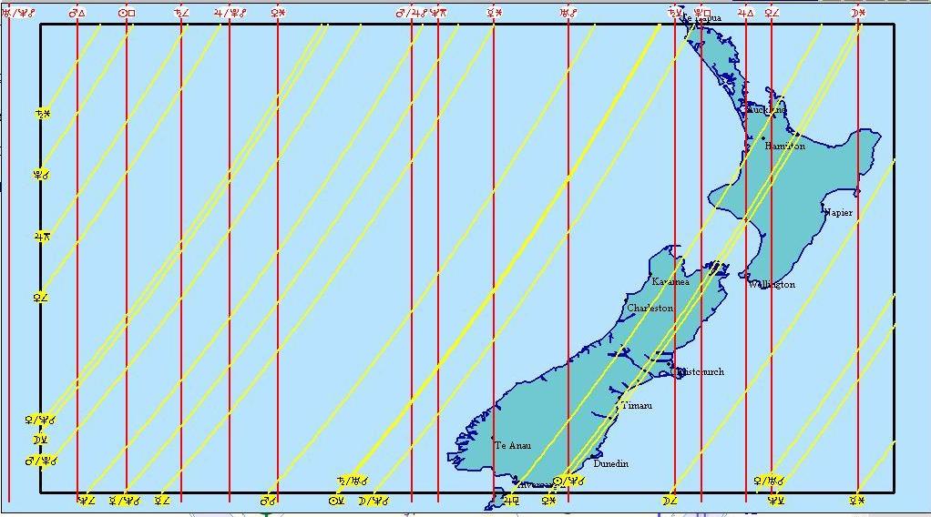
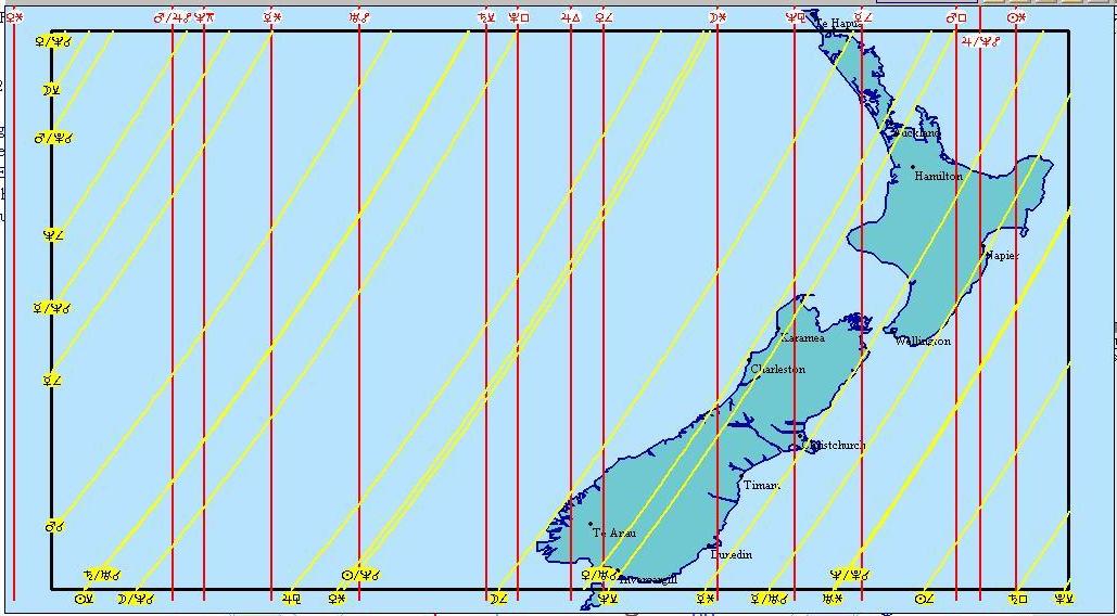
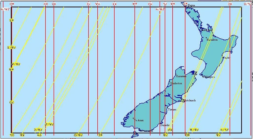
How to interpret
The red lines are set in concrete and refer to location lines of the earth for the place the chart is set for, the natal lines in astro-speak. As I have set them all for Central Plateau they mostly refer to there, although NZ is so narrow it is only a few minutes either side for the rest of the country. The yellow lines are transit lines of the planets, and refer to the sky. Look for heavier and more numerous bunches of red lines, but more particularly bunches of yellow single lines creating a thicker solid line, and where yellows may be intersecting with the reds. This is not astrology, it is astrometeorology. Usually natal charts are set for each particular person in astrology. In astrometeorology natal charts are set for locations. The influences are then plotted as to what is affecting that location, or is about to do so. So we have the concept of "my" Mars, and the real Mars, in astrology, but in astrometeorology we have Taupo's Mars at a particular moment in sky-time. So, say, as Mars embodies action, Taupo's Mars (the red line with the Mars symbol along the bottom) intesecting with the real Mars(yellow), would be a conjunction, which is considered very powerful. Compare a Mars line with a Venus line =not so powerful. Mars+Uranus is very powerful for earthquakes.
Examples of the intersection of red and yellows can be seen at the moments of the three largest Christchurch earthquakes.
4 September 2010: 7.1mag 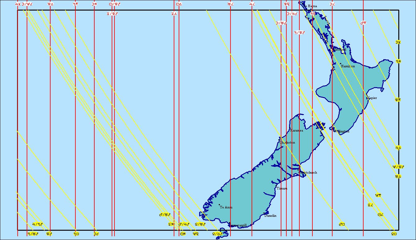
22 February 2011: 6.3mag
20 March 2011: 5.1mag (7-intensity) 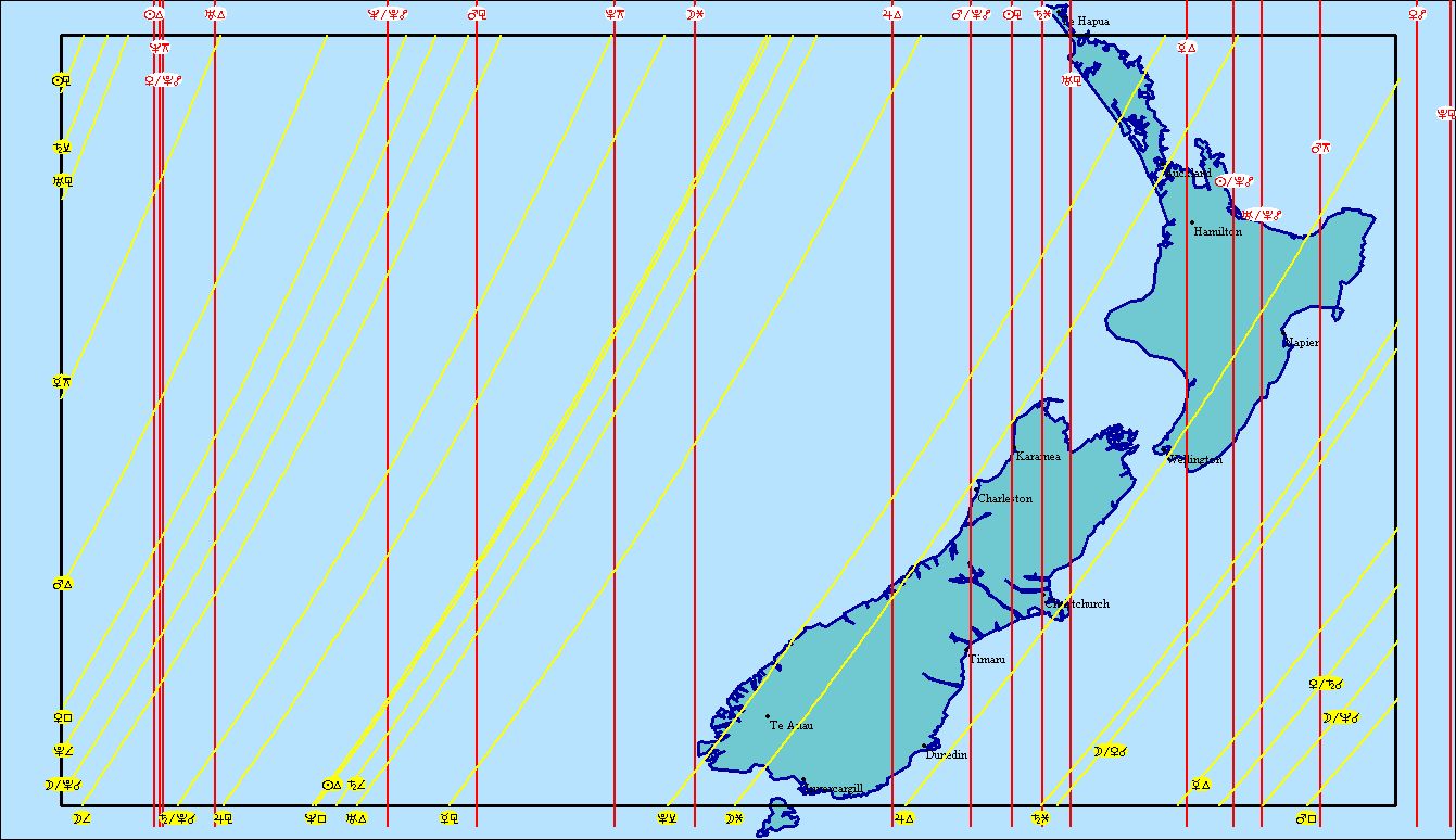
---------------------------------------------------------------------------------------------------------------------
7-9 December
In our last newsletter we listed 7 December as powerful, possibly up to 6+M somewhere.
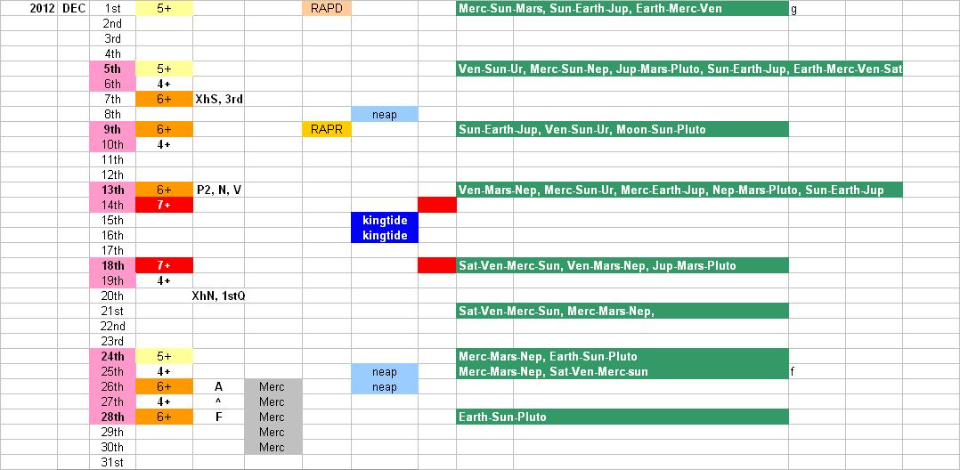
Internal energy is often released before perigees if stress build-up is great enough. I believe that is what happened on 4 September, also coming around 4 days before a powerful perigee, just like this coming perigee will bring. On 7 December from 5am peaking at 8am, Mercury will be at 90deg to the earth, lining up on its cardinal point in its orbit, with earth behind it, sitting on Mercury’s other cardinal point and the moon at last quarter (Nino Horsfall). Earth-Merc–Venus is the big alignment that seems to affect NZ. Mercury and Venus lined up when Tongariro last erupted, and also featured in 4 September 2010 and 22 February 2011. On 7 December the Moon will be overhead at 7-8am. With low tide in Christchurch 5-6am, over Gisborne around 7am and Taranaki 10am, it means the geomagnetic tide over Tongariro is about 8am. Perhaps consider Christchurch then Gisborne, then Tongariro, as potential strike spots.
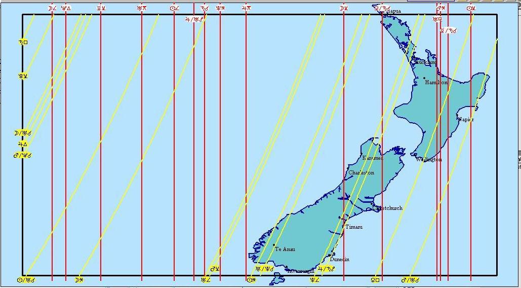
12 December 2012
Mars conjunct Uranus (earthquake aspect), Moon overhead as well, Pluto and Sun also transiting through Taupo.
To consider: 6-7am: Central Plateau, Wellington
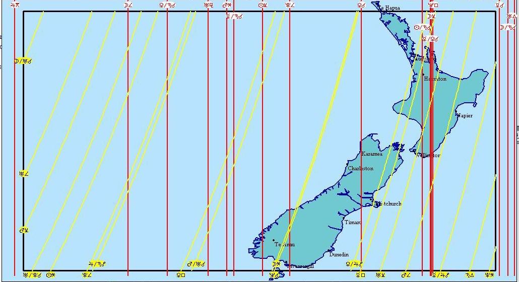
Map of 12 Dec: 6.50am.
-----------------------------------------------------------------------------------------------------------------------
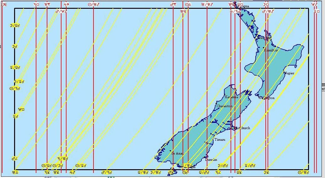
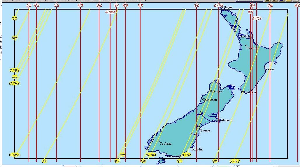
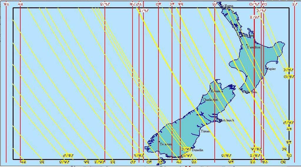
13 December 2012
Everything is crossing through the central North Island at once – Moon, Sun, Venus, Pluto, Saturn, Jupiter, Uranus.
To consider:1-2am: Canterbury, NW of SI, Milford Sound, Coromandel, C Plateau, Wairarapa, Otago, Northland. In the 1.30am map: Risk time for NorthIsland and upper South Island. Possible action through Christchurch. The influence effect area are the bunches of closer red lines, like guitar strings.
Map of
13 Dec: 1.17am
Map of 13 Dec: 1.30am
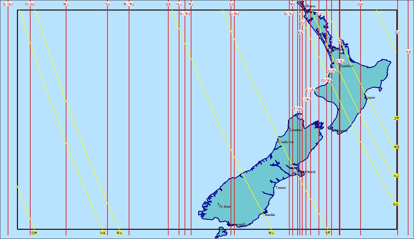
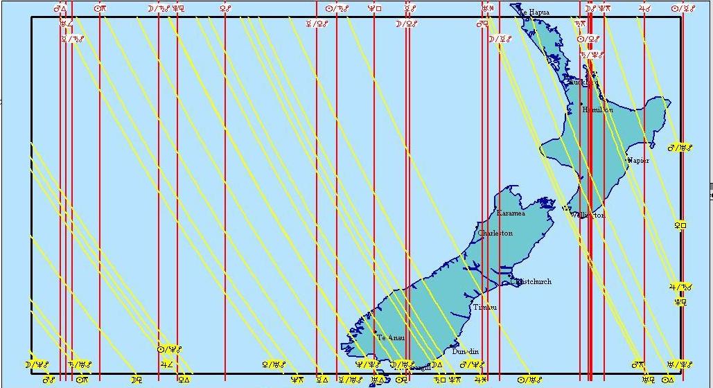
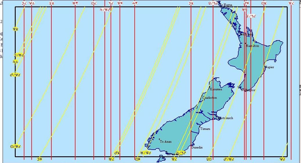
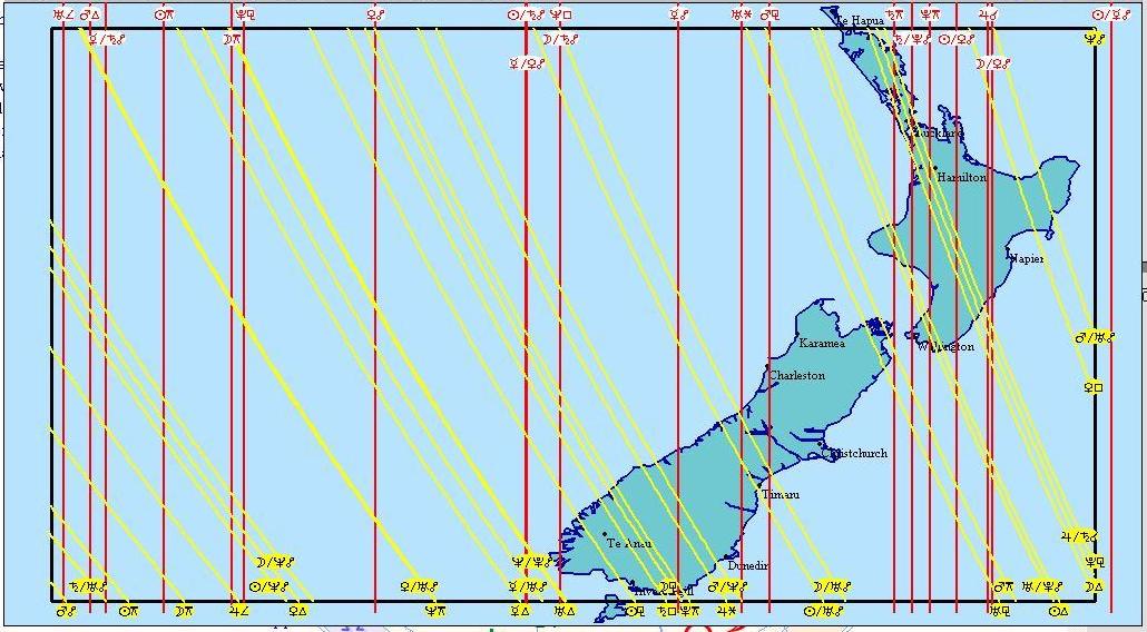
To consider: 9-11am (low tide in Christchurch): The quieter nature of these maps can be misleading. Only Venus is passing and nothing appears to be happening. But great seismic action often comes as a release after a period of maximum stress. After turbulence and the air goes calm and still, a time some have recognised as “earthquake weather”, a seismic event may arrive. As this is the low tide period, it is the high tide of the land beneath the sea.
Smaller shake possibilities in C Plateau, Wanganui, Wellington, Raglan, top of SI, Napier, coastal Marlborough, Hokitika.
Map of 13 Dec: 9am
Map of 13 Dec: 9.30am
Map of 13 Dec: 10am
Map of 13 Dec: 11.30am
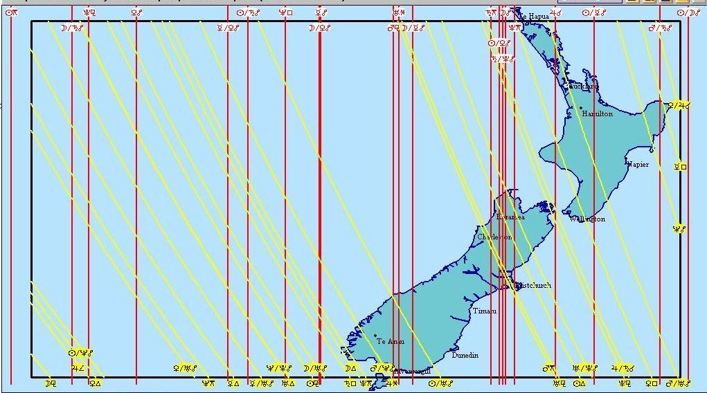
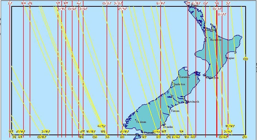
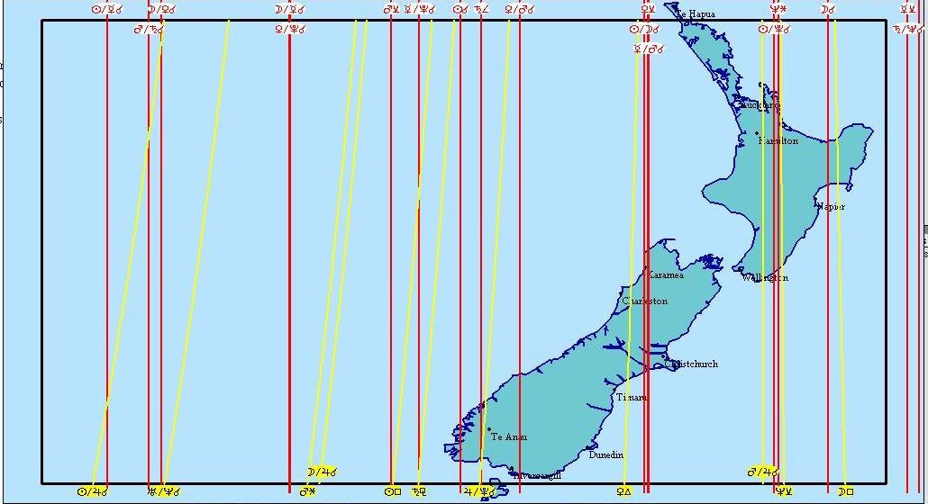
To consider: 11am-1pm: Interesting for Taupo. Sun-Pluto conjunction and Mars-Jupiter are all overhead of each other. The action line moves across Wanganui around noon, then after noon, over Christchurch. Possible action for Gisborne, Christchurch, Rotorua, Waiouru, C Plateau, NW of SI, Northland.
Map of 13 Dec: 11.57am
Map of 13 Dec: 11.58am
Map of 13 Dec: noon
Map of 13 Dec: 12.11pm
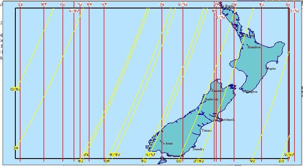
Map of 13 Dec; 2.50pm
------------------------------------------------------------------------------------------------------------------------------------------
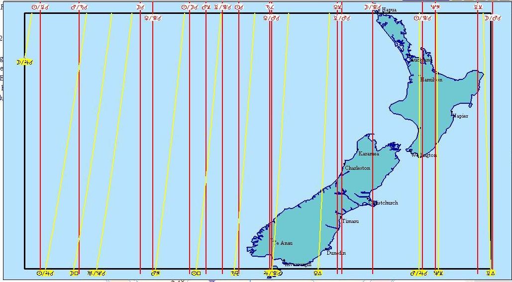
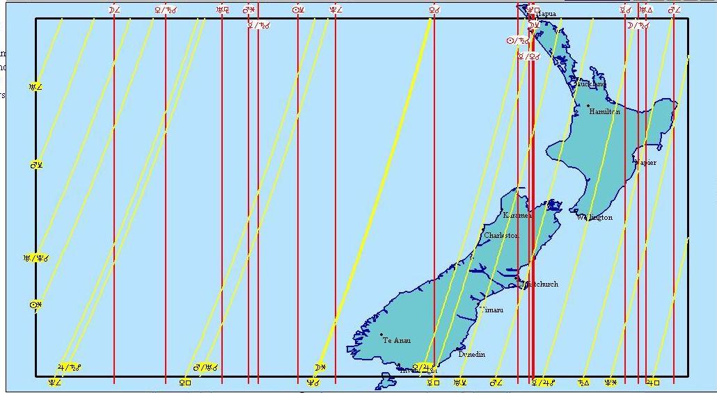
14 December 2012
Potential for more action coming for the North Island?
To consider: Central Plateau, lower North Island
Map of 14 Dec: 12.37am
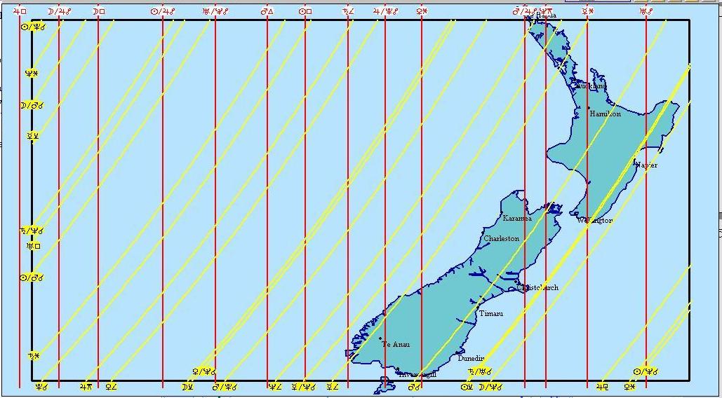
To consider: 1-3am: W Auckland, Hamilton, C Plateau, Coromandel, BoP
Lots of earthquake aspects happening for the NI. This map is similar to the previous day at the same time, except at this time the red lines are further apart, indicating an increasingly widespread area of earthquake activity which would translate to small shakes only. However, Southern Hawkes Bay, around Waipukurau, may be more seismically affected. A couple of minutes later this potential is crossing Wellington.
Map of 14 Dec: 1.17am
Map of 14 Dec: 2.15am
Midpt with Sun
To consider: 5-6am: Northland, C Plateau, ArthursPass, Otago, Te Anau.
Map of 14 Dec: 5.14am
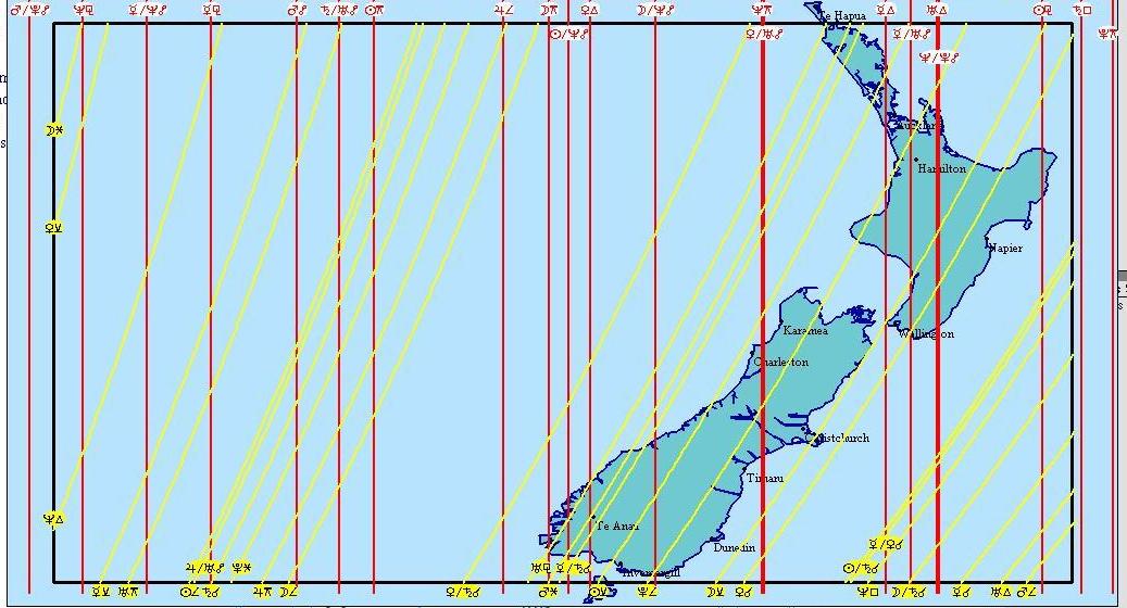
14 Dec:
Over Taupo, all these are in Conjunction – Venus, Mercury, Sun, Saturn, Moon, Neptune.
Crossing through it is the earthquake trigger Uranus.
To consider: 12am: C Plateau, Southern HB, Masterton, NW of South island.
12-1pm: Waikato, C Plat, Horowhenua, E Cape, Gisborne, N Canterbury
Map of 14 Dec: 12.39pm
14 Dec:
To consider: Northland, GoldenBay, Christchurch. Low sea tide = high land tide at Christchurch
Map of 14 Dec: 12.49pm
Map of 14 Dec: 2.47pm
Potential risk times for NZ,
(daylight saving adjusted)
7 Dec. 5-8am, Moon overhead
9 Dec: 9am, Moon overhead
13 Dec 1.45pm, Moon overhead
13 Dec, 6.45pm, Moon on horizon
14 Dec, 0:45am, Moon underfoot
14 Dec, 6.45am, Moon on horizon
14 Dec, 1.45pm, Moon overhead
--------------------------------------------------------------------------------------------------------
Summary
So will there be an eruption, earthquake, or earthquake series on or around 13-14 December, targeting the central North Island, East Cape, Wellington or Christchurch? It is for the reader to decide, and to either treat this article as a potential warning or simply dismiss it as yet another alternative theory, unsubstantiated by those with university training and therefore to be taken with a grain of salt.
Either seismic action is predictable or it is not. Either it is random, as scientists say, being only a function of the sudden movement of tectonic plates at the very surface of the earth, or the opposite possibility must be considered, which suggests that seismic activity is by no means random but structured and dependent on positions of Moon, Sun and planets, which by their angles induce enough stress on earth's electromagnetic field to generate internal pressure deep beneath the earth which can result in the occasional violent and destructive release of pressure.
We will only know if we test theories in the real world. This is why this article has been written on this date, two weeks before the time of a suggested event taking place. Some things are undeniable. The Moon will be unusually close that day, and it will be directly over the NZ and Pacific region. There will be planetary angles that many ancient cultures have in their hand-me-down teachings listed as earthquake-risk relevant.
Perhaps nothing will occur. If so then no harm has been done. It is no different to saying a road may be busier at a certain time, and so it would be wise to take extra precautions crossing it. But if something does occur, and people are in the region affected, then some good will have been done if those people have equipped themselves appropriately.
There are many examples in history of serious seismic events occurring in times of perigee and when the Moon transits a location. Whether this is another one of those, whether it puts any of us at any personal risk and what we should do around 13-14 December remains the responsibility of the reader.
Latest Updates
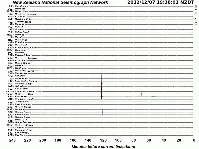
Eruptive activity
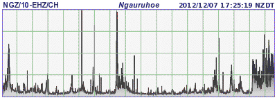
Note the increase in activity over the past 24 hours.
ALSO
An earthquake has just occurred in Christchurch, 7 December.
You can just see it at the bottom of the graph.
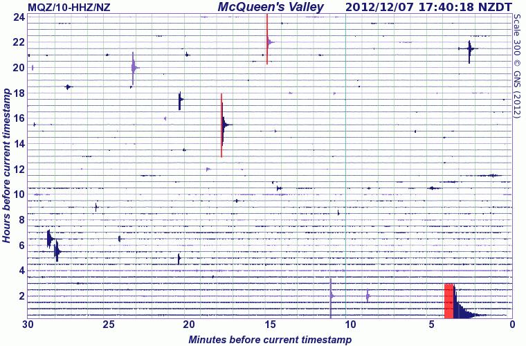
The last time there was an earthquake as big in Christchurch was 10 November, which was 4-5 days before the November perigee. Once again the pre-perigee event. Today's Christchurch earthquake of 3.9mag can be seen as the result of seismic activity covering a fairly wide area.
(ackowledgement Geonet:)
ALSO
An earthquake has occurred in Westport, 7 December, a 5.4mag
Public Id: 2012p922498
NZDT: Friday, December 7 2012 at 8:46:12 pm
Intensity: strong
Depth: 20 km
Magnitude: 5.4
Location: 30 km north-west of Westport
ALSO
An earthquake occurred in Whitianga, 7 December, a 4.1mag
Public Id: 2012p922577
NZDT: Friday, December 7 2012 at 9:29:41 pm
Intensity: unnoticeable
Depth: 408 km
Magnitude: 4.1
Location: 25 km north-west of Whitianga
ALSO
An earthquake has just occurred in Rotorua, 7 December
Public ID 2012p922498
Universal Time December 7 2012 at 7:47:23
NZ Daylight Time Friday, December 7 2012 at 8:47:23 pm
Latitude, Longitude -38.28, 176.14
Intensity ? weak
Focal Depth 7 km
Magnitude 2.3
Location 20 km south-west of Rotorua
ALSO
An earthquake has occurred in Taupo, 7 December
Public Id: 2012p922139;
NZDT: Friday, December 7 2012 at 5:36:01 pm;
Intensity : ... weak;
Depth: 10 km;
Magnitude: 2.1;
Location: 10 km north of Taupo; Felt it?
ALSO
An earthquake 7.3mag has occurred in Japan, 7 December, one of seven large shakes.
At first a tsunami warning has been issued.
Reactors may have to be shut down
Moon at or near underfoot for all above event times.
Seismic readouts can be checked by the public.
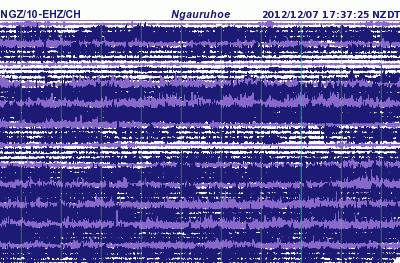
We do not have to wait to receive warnings from scientists. Moon rise/set positions are listed in most daily newspapers. Moon rise or set is Moon on horizon. Halfway between moonrise and set is Moon overhead. Halfway between moon set and next moonrise is Moon underfoot. The website for the above graph, which changes hourly and daily, is http://geonet.org.nz/volcano/info/ngauruhoe/drums
ALSO
An earthquake has occurred in Tokoroa, 8 December, a 6.3
Region: NORTH ISLAND OF NEW ZEALAND
Geographic coordinates: 38.334S, 176.044E
Magnitude: 6.3 Mwb
Depth: 167 km
Universal Time (UTC): 7 Dec 2012 18:19:08
Time near the Epicenter: 8 Dec 2012 07:19:08
Local standard time in your area: 7 Dec 2012 18:19:08
http://earthquake.usgs.gov/earthquakes/eventpage/usc000e5z5#summary
downgraded by local geologists?
Public Id: 2012p923684
NZDT: Saturday, December 8 2012 at 7:19:05 am
Intensity: moderate
Depth: 182 km
Magnitude: 5.8
Location: 20 km south-east of Tokoroa
Moon overhead Tokoroa
Recent earthquakes
Mag
6.4 101km SSE of Lakatoro, Vanuatu 2012-12-02 00:54:23, Moon underfoot
5.9 91km NW of Aleneva, Alaska 2012-12-01 08:00:57, 3hrs from Moon overhead
5.5 169km W of Neiafu, Tonga 2012-11-30 11:20:36, 3hrs from Moon overhead
5.0 57km WSW of Attu Station, Alaska 2012-11-29 23:22:35, Moon underfoot
5.2 69km SSW of Champerico, Guatemala 2012-11-29 19:32:34, Moon underfoot
5.9 157km ENE of Angoram, PNG 2012-11-29 11:10:27, 3hrs from Moon overhead
5.5 102km W of Morrope, Peru 2012-11-29 07:09:13, 1 hour after Moon overhead
5.0 49km S of Ndoi Island, Fiji 2012-11-29 00:30:32, Moon underfoot
5.0 30km W of Jijel, Algeria 2012-11-28 23:15:29, Moon overhead
5.1 96km ENE of Chichi-shima, Japan 2012-11-28 15:07:43, Moon overhead
5.5 183km W of Tual, Indonesia 2012-11-28 08:56:16, Moon on horizon
5.2 289km SSW of Severo-Kuril'sk, Russia 2012-11-27 14:42:15, Moon overhead
© Ken Ring 2012